
Explore accurate tide charts and tables for
New Jersey fishing, shellfishing, boating and beach outings.
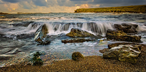
Stations and tide pools are covered in the map.
Popular: Atlantic City • Avalon Bay • Barnegat Inlet • Beach Haven • Cape May Beach • Long Beach • Manasquan Inlet • Ocean City • Sandy Hook • Seaside Heights • Ventnor City • Wildwood
New Jersey Tide Stations
Alloway Creek: Abbots Meadow • Alloway Creek 2.5mi Up • Alloway Creek Entrance • Coopers Creek bridge • Quinton
Arthur Kill: Carteret • Chelsea • Rahway River • Woodbridge Creek
Barnegat Bay: Barnegat Inlet • Barnegat Pier • Beaverdam Creek Entrance • Cedar Creek • Coates Point • Double Creek • Forked River • Goose Creek entrance • High Bar • Island Beach • Island Beach State Park • Kettle Creek • Loveladies Harbor • Mantoloking • Ocean Beach • Oyster Creek • Seaside Park, NJ • Silver Bay Marina • Sloop Creek • Stouts Creek • Toms River • Waretown
Bass River: New Gretna
Big Timber Creek: Westville
Cape May: Bennett Creek • Cape Island Creek • Cape May Beach • Cape May Inlet • Delaware Bay • Ferry Term • Sunset Beach Point
Cheesequake Creek: Garden State Parkway Bridge
Cooper River: Pavonia
Corson Inlet: Ludlam Bay • Strathmere
Delaware Bay: Bidwell Creek entrance • Brandywine Shoal Light • Dias Creek Route 47 bridge • Dividing Creek entrance • East Creek Route 47 bridge • Fishing Creek entrance • Mad Horse Creek • Maurice River • North Highlands Beach • Riggins Ditch
Delaware River: Auburn • Billingsport • Burlington • Burlington • Salem Canal • Ship John Shoal • Stow Creek Canton
Dock Thorofare: Risley Channel
Great Bay: Beach Haven • Graveling Point • Little Sheepshead Creek
Great Bay, NJ: Long Beach
Great Channel: Stone Harbor
Great Egg Harbor: Beesleys Point • Mays Landing • Ocean City • River Bend Marina • Tuckahoe • Tuckahoe River
Hackensack River: Berrys Creek • Carlstadt • Hackensack • Kearny Point • New Millford • North Secaucus • Ridgefield Park • RR bridge
Hereford Inlet: Nummy Island • Old Turtle Thorofare • West Wildwood
Hoffman Thorofare: Brigantine Channel
Hollywood Beach: The Glades
Hudson River: Alpine • Edgewater • Weehawken
Lakes Bay: Pleasantville
Little Egg Harbor: Cedar Run • Dinner Point Creek • Parker Run • Tuckerton • Tuckerton Creek entrance • West Creek • Westecunk Creek entrance
Long Branch: Long Branch • Long Branch
Malapartis Creek: Pine Island
Manahawkin Bay: Flat Creek • Manahawkin Creek • Manahawkin Drawbridge • North Beach
Manasquan River: Brielle • Manasquan Inlet • Riviera Beach
Mantua Creek: Mantua • Paulsboro
Manumuskin River: Port Elizabeth
Maurice River: Menantico Creek entrance • Millville
Metedeconk River: Forge Pond • Tall Pines Camp
Metedoconk River: Beaverdam Creek
Middle Thorofare: Ocean Drive Bridge
Mullica River: Cramers Boatyard • Green Bank • Nacote Creek • Sweetwater • Wading River
Navesink River: Red Bank
Newark Bay: Port Elizabeth
Newmans Thorofare: Seven Island
Oldmans Creek: Pedricktown
Passaic River: Arlington • East Rutherford • Point No Point
Patcong Creek: Steelmanville
Raccoon Creek: Bridgeport
Rancocas Creek: Bridgeboro • Hainesport • North Branch
Raritan Bay: Keyport
Raritan River: Keasbey • New Brunswick • Sayreville • South Amboy
Route 35 bridge, Matawan Creek
Route 47 bridge: West Creek
Route 73 Bridge: Pennsauken Creek
Salem River: Salem • Sinnickson Landing
Sandy Hook Bay: Fort Hancock • Sandy Hook
Shark River: Belmar • New Bedford • Shark River Hills • Shark River Island
Shrewsbury River: Gooseneck Point bridge • Highlands • Long Branch Reach • Navesink River • Sea Bright
South River: Old Bridge
Stow Creek: Stathems Neck
Townsends Inlet: Ingram Thorofare • Ocean Drive bridge • Stites Sound • Townsend Sound
Best Tide Pools in New Jersey
New Jersey’s coastline offers unique tidepooling opportunities. Below are some top spots known for their marine life. Tidepools are marked on the Map tab above in red. The titles below are linked to the tide page that supports that locations tide pool charts.
Barnegat Lighthouse State Park - Located on the northern tip of Long Beach Island, about 1.5 hours from Trenton, this park features granite jetties that create small intertidal zones and pools at low tide. Families can explore for fiddler crabs, periwinkle snails, barnacles, and occasional small fish in these protected rocky areas near the iconic lighthouse.
Cape May Point State Park - At the southern tip of New Jersey near Cape May, concrete jetties and the World War II bunker create protected areas with small tide pools at low tide. Great for families - observe crabs, barnacles, periwinkles, and wading birds in this scenic, lighthouse-adjacent park.
Island Beach State Park - Just south of Seaside Park, this 10-mile barrier island preserve offers jetties and minor rocky patches where low tides expose intertidal zones. A family-friendly spot with easy access; spot mussels, hermit crabs, small fish, and shorebirds in shallow pools and sandy flats.
Port Aransas Jetty (at Barnegat Inlet) - Near Barnegat Light, the granite jetties at Barnegat Inlet form rocky intertidal zones accessible at low tide. Popular for family exploration; find anemones, crabs, snails, and small marine life clinging to the rocks in calm pools.
Sandy Hook (Gateway National Recreation Area) - At the northern end of the Jersey Shore in Highlands, rocky areas and old structures near the tip create limited intertidal zones. Family-oriented with beaches and trails; spot crabs, snails, and small fish during low tides in this historic peninsula setting.