
Explore accurate tide charts and tables for
Texas fishing, shellfishing, boating and beach outings.
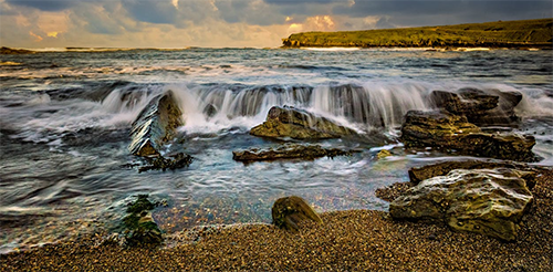
Stations and tide pools are covered in the map.
Texas Tide Stations
Aransas Bay: Rockport
Barbours Cut: Morgans Point
Copano Bay: Copano Bay State Fishing Pier
Corpus Christi: Packery Channel
Corpus Christi Bay: Port Ingleside
Galveston Bay: Clear Lake • Eagle Point • Galveston • Gilchrist • Houston Ship Channel • Morgans Point • North Jetty entrance • Port Bolivar • Port of Galveston • South Jetty entrance • Texas City
Lavaca Bay: Port Lavaca
Matagorda Bay: Port O'Connor
Neches River: Rainbow Bridge
Nieces Bay: Whites Point
Padre Island: Padre Island • Brazos Santiago Pass
Port Aransas: Port Aransas • H Caldwell Pier • Port Aransas
Port Arthur: Sabine Lake
Port Isabel: Laguna Madre
Sabine Pass: Sabine Pass • Mesquite Point
San Antonio Bay: Seadrift
San Jacinto River: Lynchburg Landing
Trinity Bay: Point Barrow • Round Point
USCG: Freeport
West Bay: Alligator Point • Jamaica Beach
Best Tide Pools in Texas
Texas’s coastline offers unique tidepooling opportunities. Below are some top spots known for their marine life. Tidepools are marked on the Map tab above in red. The titles below are linked to the tide page that supports that locations tide pool charts.
Galveston Island State Park - About 1 hour from Houston, this park’s tidal zones near its jetties host mussels and crabs at low tide.
Matagorda Bay Nature Park - At the mouth of the Colorado River near Matagorda, jetties and bay shores expose limited intertidal zones with barnacles, periwinkles, and crabs. A quiet, nature-focused spot great for family observation.
Mustang Island State Park - South of Port Aransas on Mustang Island, the park's jetties and rocky patches create small tide pools at low tide. Family-friendly with camping and facilities; spot crabs, small fish, mussels, and barnacles in calm intertidal zones.
Padre Island National Seashore - Located 2 hours from San Antonio, this seashore’s small tide pools near its jetties feature barnacles and periwinkles at low tide.
Port Aransas Jetty - At the Horace Caldwell Pier and granite jetties in Port Aransas, low tides expose rocky areas with anemones, sea urchins, periwinkle snails, barnacles, crabs, and occasional octopuses. A popular family spot for exploring man-made "tide pools" along this high-traffic beach area.
Quintana Beach County Park - Near Freeport south of Galveston, jetties and rocky breakwaters form minor pools and intertidal areas. Good for families spotting crabs, mussels, and small marine life; accessible with park amenities.
Rockport Beach - About 2.5 hours from San Antonio, this beach’s jetties host tide pools with crabs and small fish at low tide.
Sea Center Texas (Lake Jackson) - In Lake Jackson near Freeport, this hatchery and wetland area includes educational tidal exhibits and nearby marshy zones with small crabs and fish visible at low tide. Family-oriented with indoor/outdoor learning opportunities.